Subject: Canada & United States
Period: 1836 (dated)
Publication:
Color: Hand Color
Size:
37 x 25 inches
94 x 63.5 cm
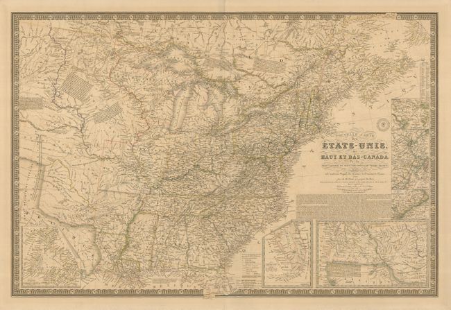
This large and unusual map shows the United States east of the Texas panhandle and Arkansas and Missouri River valleys, which are divided into the Ozark, Osage, Sioux, and Mandan Indian Districts. The map is beautifully engraved and incredibly detailed, particularly of the roads and railroads. Notations throughout concern the Indian tribes, river courses, and early western trails. Sheet includes seven insets: Newfoundland, Southern Florida, Western United States, Philadelphia & Trenton vicinity, New York City vicinity, Boston vicinity and Baltimore & Washington -- all surrounded in a bold keyboard style border. Printed on thick paper with the embossed seal of the Brue firm..
References:
Condition: A
Original color on a thick sheet. The map has some light offsetting, and there are a few short tears in the blank margin. The verso has some hinge remnants, and the centerfold has been reinforced with tissue.