Subject: Northern Hemisphere
Period: 1770 (dated)
Publication:
Color: Hand Color
Size:
18 x 18 inches
45.7 x 45.7 cm
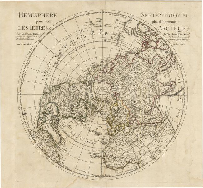
This important map of the Northern Hemisphere was the first map to correctly place the west coast of North America by moving it east substantially from previous mapping. California is correctly shown as a peninsula. Instead of the blank northwest coast as shown on earlier editions of the map, this later example has a wonderful and elaborate Northwest Passage, based on the alleged travels of Juan de Fuca. The mythical Mer de l'Ouest is noted, as are the fictional lakes Velasco and Fonte. Near the Asian coast, an expansive Presqu' Isle du Nord-Ouest is shown reaching toward Kamchatka. Above Japan, the Isles du Ieso (Hokkaido) is shown with an uncertain coastline.
References: cf Wagner #504.
Condition: B
A dark impression on a sheet that has been backed with linen, apparently for inclusion in a sea atlas. The map has some damp staining, mostly affecting the margins. Slightly faded original outline color.