Subject: Polar
Period: 1779 (circa)
Publication:
Color: Hand Color
Size:
16 x 12.5 inches
40.6 x 31.8 cm
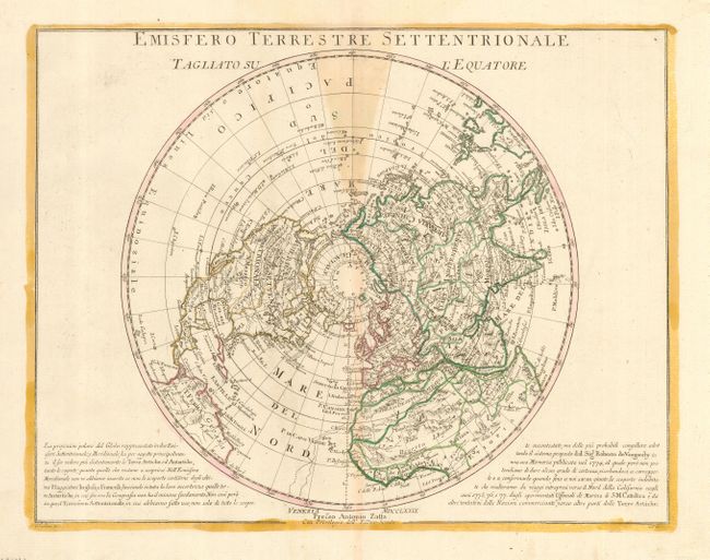
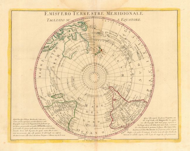
Handsome pair of North and South polar projections that are based on the cartography of Delisle. On the map of the North Pole in North America, the mythical Northwest Passage is shown connecting through the Strait of Anian to Hudson Bay. The Beautiful River (R. Bella Riviera) is also shown nearly connecting the Mississippi River with the Pacific. In the Southern Hemisphere, the voyages of Bougainville and Cook (first voyage) are noted. New Zealand is completely depicted, and the coasts of Australia are beginning to become more defined.
References:
Condition: B
Nice impressions on sturdy sheets. Both maps with original outline color and some light damp stains at the top and into the centerfold. There is a tiny bit of worming in the bottom blank margin.