Subject: World
Period: 1860 (dated)
Publication: New General Atlas
Color: Hand Color
Size:
13 x 11 inches
33 x 27.9 cm
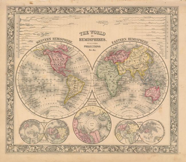
1) A lovely double hemisphere map with Mitchell's unique floral border and beautiful hand coloring. Below the world map are three smaller maps: The World on a Polar Projection, North Polar Region and Land and Water Hemispheres. A comparative diagram of the world's rivers is shown above the maps with the note "Sea of Uniamezi Probable Source of the Nile."
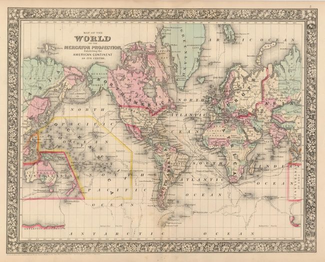
2) Finely engraved, double-page map featuring the tracks of several explorers, including Cook, Gore, and Ross. In this first edition map, the continent of Antarctica is named, but only small portions of its coastline are delineated, naming Graham's Land, Palmer's Land, and showing the track of the U.S. Exploring Expedition. The Trans-Atlantic telegraph cable is shown between Newfoundland and Ireland, but not yet extending to . Alaska is here Russian Territory. The map has strong decorative border characteristic of the 1860 edition.
References:
Condition: B+
Fine color with original margins. With some light occasional foxing or offsetting.