Subject: Western United States
Period: 1857 (circa)
Publication: Colby's Diamond Atlas
Color: Hand Color
Size:
5 x 6.5 inches
12.7 x 16.5 cm
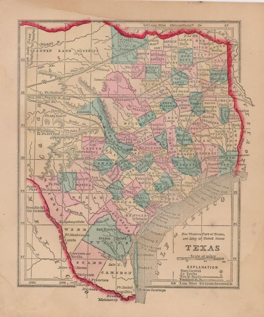
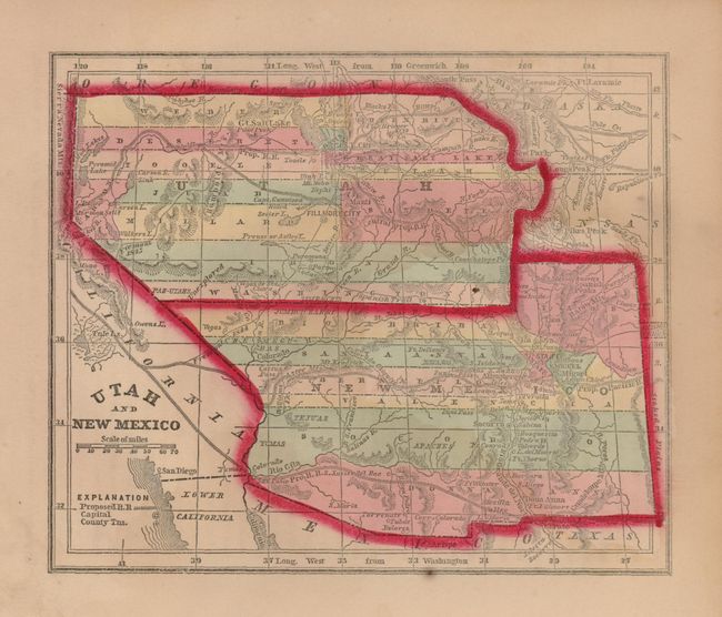
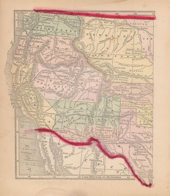
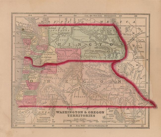
These maps features the remarkable border configurations present in the mid-1850's. Washington and Oregon show sparse settlements only in the extreme west, but their boundary stretches east to the Continental Divide in the Rocky Mountains. The Emigrant Route is clearly shown following the Snake River and then the Columbia on it's way to Oregon City (Portland). Utah and New Mexico likewise show configurations with large, expanded boundaries with no sign of Wyoming, Colorado or Arizona. Locates the proposed rail routes and shows Fillmore City as Utah's Territorial capital. The map of Texas shows county development mostly in the east and southern portions. Extends north to the Red River. The untitled map of the west shows the regions of the other maps plus the huge region east of Washington & Oregon called Nebraska Territory. Includes all of California and shows many existing and planned railroads. A nice collection of western themed map with original hand coloring.
References:
Condition: B
Each with full margins and bright, original coloring. With a little damp staining, mostly in margins.