Subject: United States - Mid-Atlantic
Period: 1780 (published)
Publication: Universal Magazine Atlas
Color: Black & White
Size:
13 x 11 inches
33 x 27.9 cm
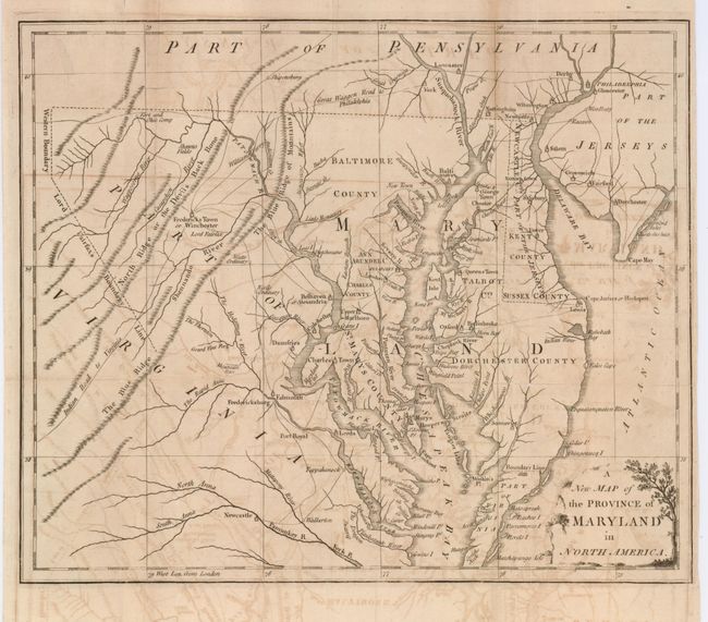
This copper engraved map was issued during the Revolutionary War. It covers the region of Chesapeake Bay with great detail of settlements and roads, including the "Indian Road to Virginia" and the "Great Waggon Road to Philadelphia". Locates Fredericksburg, Charles Town, Oxford, Philadelphia, and Annapolis. Delaware is labeled "Newcastle C. Part of the Jerseys". The Western Boundary and Lord Fairfax's Boundary Lines are shown. The Boundary Line of 1688 is noted between Maryland and Virginia adjacent to Watkin's Point. Decorative title cartouche.
References: Jolly UNIV-184; Sellers and van Ee #1412; Phillips (M) pg. 394
Condition: B
The map has overall light offsetting. On fine hand laid paper with two large watermarks. One or two folds with long splits closed on verso with archival tape.