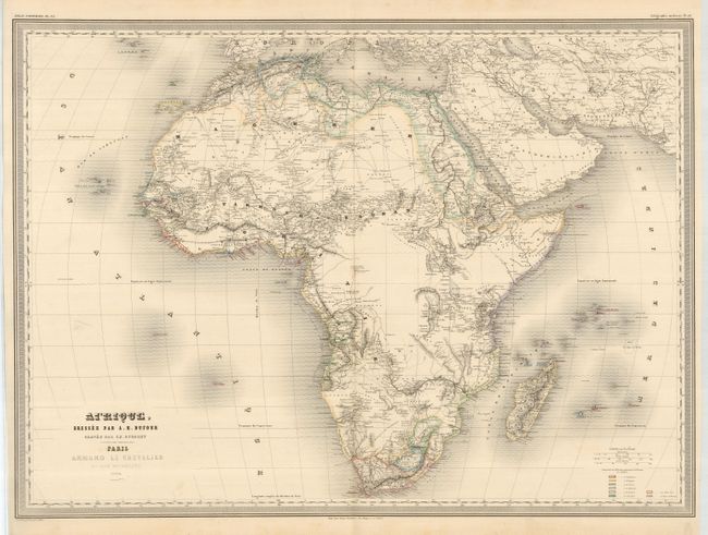
Subject: Africa
Period: 1864 (dated)
Publication: Grand Atlas Universel
Color: Hand Color
Size:
29.5 x 21.5 inches
74.9 x 54.6 cm
A large, and beautifully engraved steel-plate map of the continent includes the Arabian Peninsula, a portion of Asia Minor, and the Canary and Seychelles Islands. This highly detailed example shows partially developed topography with presumed courses of rivers, and large, unexplored areas left blank. Other interesting details include desert trade routes and the Montagnes de la Lune, or the Mountains of the Moon. These fabled and mysterious mountains are the Ruwenzori mountain range, whose unusual equatorial snows feed Lake Albert, an important source of the Nile. Color coding defines the European colonial powers present, and are identified in a legend at lower right. Three distance scales and fine border. A very nice example.
References:
Condition: A
Some light toning in margins, and a spot of foxing in Mediterranean. A crisp impression on bright paper with fine, original coloring.