Subject: Africa
Period: 1749 (published)
Publication: Histoire Generale des Voyages…
Color: Black & White
Sharply engraved lot of maps, views and botanicals of Africa from Prevost's massive history of exploration. Most of the maps are by Jacques Nicolas Bellin, decorated with compass roses and ornamental cartouches. The lot includes a xerox copy of the title page.
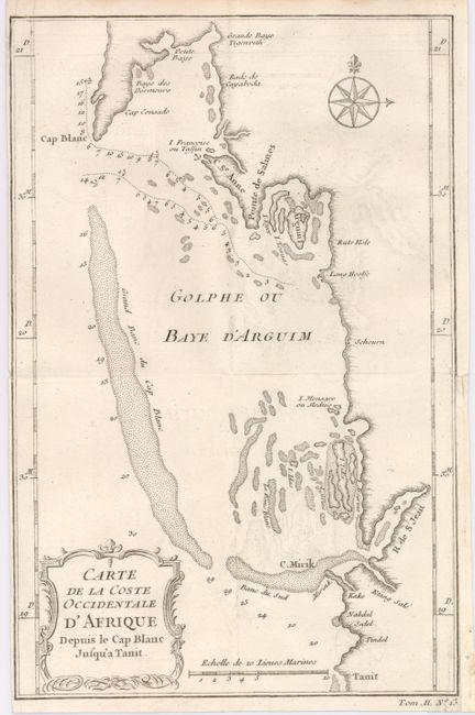
1) Carte de la Coste Occidentale d'Afrique Depuis le Cap Blanc Jusqu'a Tanit details the Bay of Arguin on the Atlantic shore of Mauritania in Northwest Africa. (6 x 9")
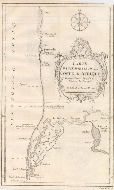
2) Carte d'Une Partie de la Coste d'Afrique Depuis Tanit Jusqu'a la Riviere du Senegalis a map of the border region between Senegal and Mauritania in western Africa, defined by the Senegal River. (5.5 x 9.4")
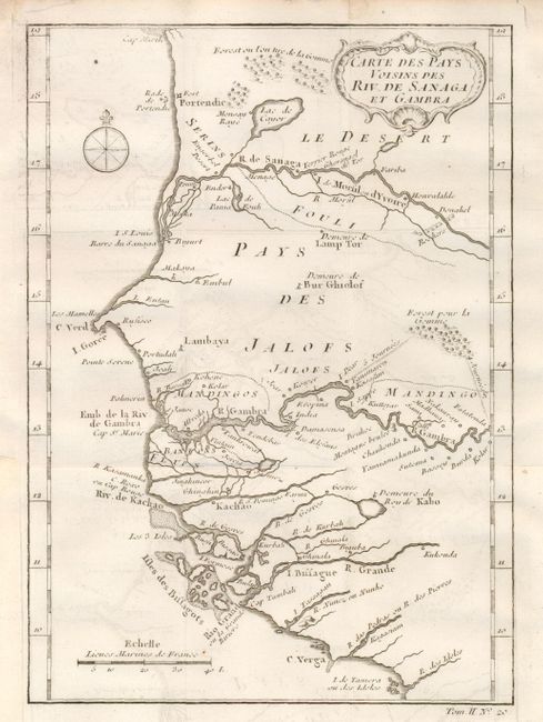
3) Carte des Pays Voisins des Riv. De Sanaga et Gambra details the western coastal African regions of Cameroon and Sierra Leone around the Sanaga and Gambra Rivers. (6.3 x 8.5")
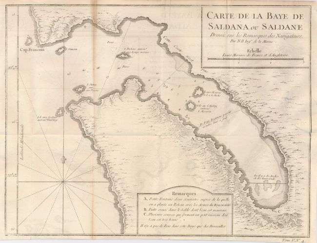
4) Carte de la Baye de Saldana ou Saldane Dressee sur les Remarques des Navigateurs is a small sea chart of Saldanha Bay, northwest of Capetown in South Africa. (10.8 x 8.3")
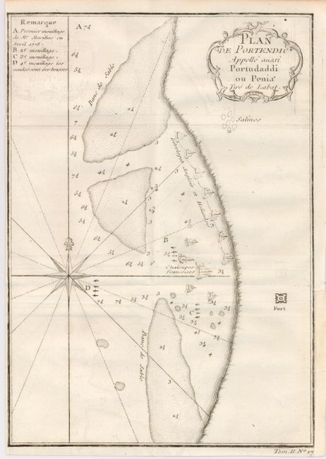
5) Plan de Portendic Appelle aussi Portudaddi ou Penia Tire de Labat is a chart of the small port of Marsa in western Africa noting the fort, as well as soundings and navigational hazards. (5.8 x 8.3")
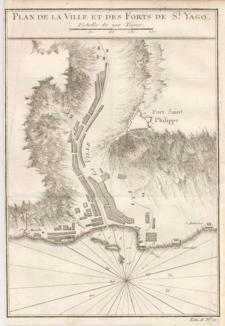
6) Plan de la Ville et des Forts de St. Yago is a view of a coastal area of the island of Sao Tiago in the Cape Verde Islands off the coast of western Africa. (5.8 x 8.3")
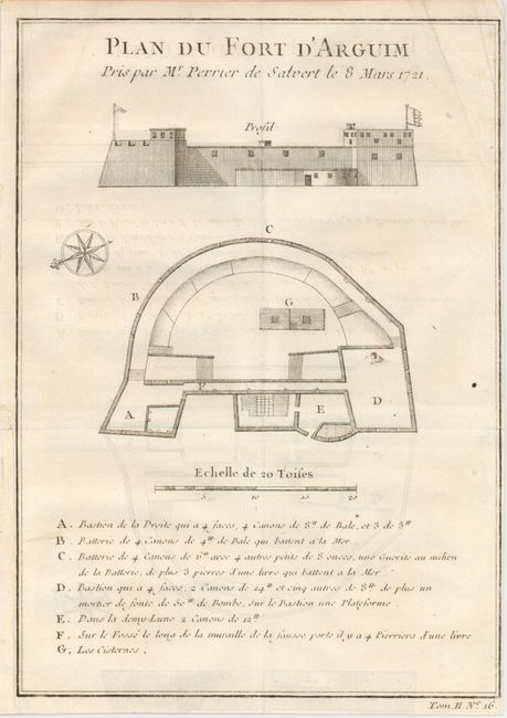
7) Plan du Fort d'Arguim Pris par Mr. Perrier de Salvert le 8 Mars 1721 shows a plan and profile of the fort at Arguim in Mauritania. (5.8 x 8")
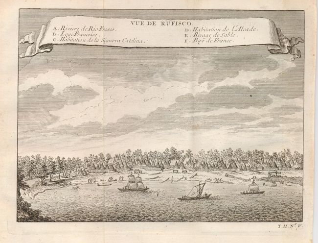
8) Vue de Rufisco shows a panoramic view of the town of Rufisque on the coast of Senegal with a key to the places of note. (7.2 x 5.3")
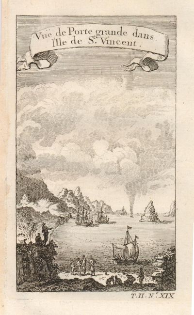
9) Vue de Porte grande dans l'Ile de St. Vincent is a lovely little view of the port on the Cape Verdean island of Sao Vicente. (2.8 x 4.6")
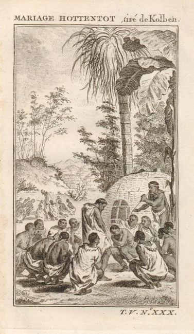
10) Mariage Hottentot, tire de Kolben is a depiction of a Hottentot marriage ceremony. (2.8 x 4.6")
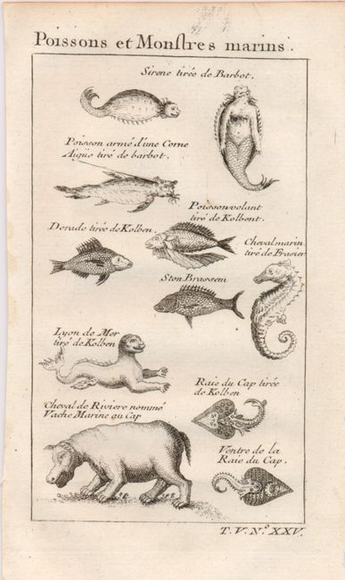
11) Poissons et Monstres marins describes the sea monsters and fish to be found in African waters, including a mermaid, an aquatic lion and more conventional hippos and seahorses. (2.8 x 4.6")
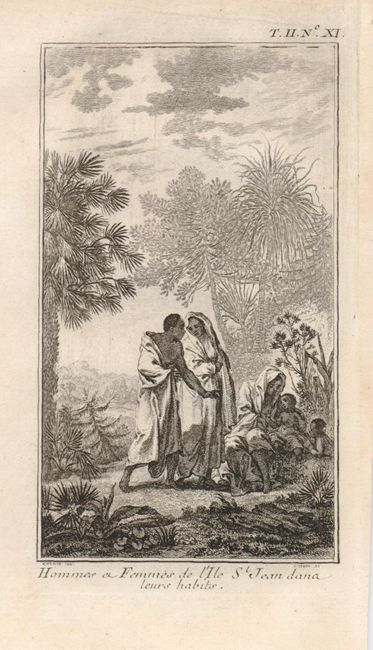
12) Hommes a Femmes de l'Ile St. Jean dana leurs habits shows the inhabitants of St. Jean island. (2.8 x 4.6")
13) Plantes du Cap is a small description of two plants found near Capetown. (2.8 x 4.6")
14) Ile de S. Philippe ou de Fuego avec son Volcan is a view of the approach to the volcanic Fogo Island in the Cape Verde island group. (2.8 x 4.6")
15) Maniere de Battre le Bled Parmi les Hottentots is a view of native Africans with some distinctive forked tools and horses. (2.8 x 4.6")
16) Danse et Musiquedes Hottentots shows a native group dancing as well as a drum and a stringed instrument. (2.8 x 4.6")
17) Reptiles et Oifeaux shows some native snakes and birds, including spectacled cobras, horned vipers, flamingos and an African penguin. (2.8 x 4.6")
References:
Condition: B+
Nice impressions with occasional light offsetting and close margins. A couple maps have small repaired tears on the binding side. All with folds, as issued.