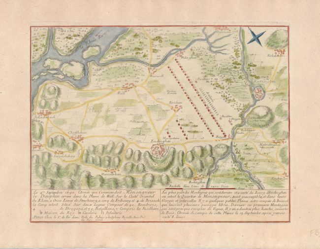
Subject: Germany
Period: 1705 (dated)
Publication: Les Forces de l' Europe…
Color: Hand Color
Size:
11 x 8.3 inches
27.9 x 21.1 cm
Interesting battle plan made at the time of the War of the Grand Alliance. This plan shows the field of battle near Endingen on the east coat of the Rhine. The locations for the Musketeers (Mousquetaires), artillery, fusilliers and dragoons are noted. In the aftermath of the Thirty Years' War, which had devastated large parts of southern Germany, the League of Augsburg was formed in 1686 between Leopold I, Holy Roman Emperor, and various German princes to oppose Louis XIV's aggression in Germany. The League of Augsburg became known as the "Grand Alliance," with England, Portugal, Spain, Sweden, the United Provinces, and most of the German states opposing France. The war came to an inconclusive end in 1696.
References: Pollak #21, pp.40-43.
Condition: A+