Subject: Wales
Period: 1690 (circa)
Publication:
Color: Hand Color
Size:
17.6 x 13.5 inches
44.7 x 34.3 cm
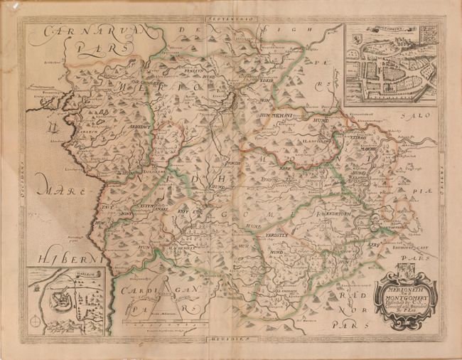
Attractive county map with characteristic detail of the topography and towns. Inset of the town of Montgomery at top right is balanced by Harlech, showing Harlech Castle, at lower left. The sea is stipple engraved and embellished with a ship. The map is also decorated with a distance scale topped by calipers and title cartouche topped with a coat of arms.
References:
Condition: B
Original outline color, slightly faded on a toned sheet with three small punctures and a spot of abrasion on the lower neatline. Hole in upper left corner margin, not affecting the map. Faint damp stain in the sea.