Antique Maps, Charts, Atlases and Globes for Sale at Auction

Old World Auctions - Antique Map Specialists


Antique Map Auction Sale No. 121 - closed 9/26/2007

Featuring 885 lots of rare antique maps, charts, pocket maps, globes and atlases
Prices Realized       Table of Contents       Search Auction


Lot #374: "[Lot of 2] Het Eyland St. Christoffel / Het Eyland Antego / Een Gedeelte van de Eylande van America [together with] Isle St. Christophle une des Antilles aux Anglois / La Barbade une des Antilles aux Anglois Divisee par Paroisses" [blank]

Antique map chart Lot of 2 Het Eyland St Christoffel  Het Eyland Anteg
Click to see full size image(s)

Estimate:
$170.00 - $210.00
Sold for: $140.00

Lot 374
By: [blank]
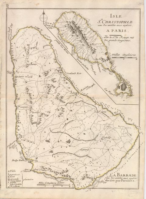
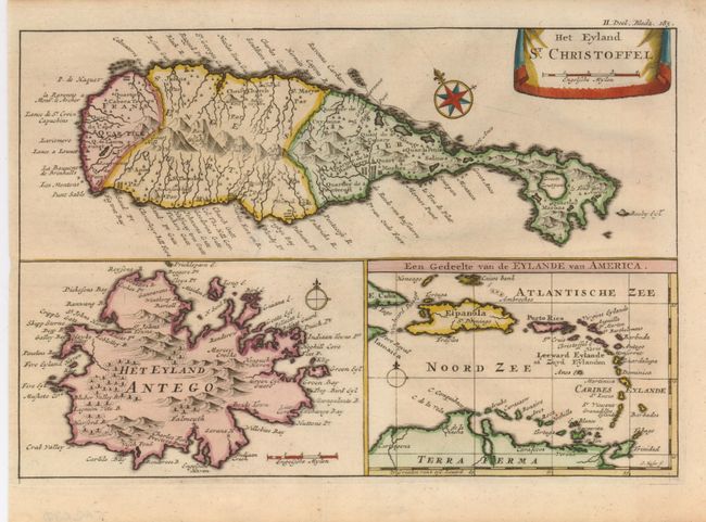
Subject: St. Kitts, Antigua and Barbados
Date: 1721-1748

Publication:

Condition: A
See Condition Guidelines

Color: hand color

Size: 0 x 0 inches
0.0 x 0.0 cm

An attractive pair of 18th century maps from two of the most accomplished mapmakers of the period.

1) Het Eyland St. Christoffel / Het Eyland Antego / Een Gedeelte van de Eylande van America is an uncommon map of St. Kitts and Antigua inset on a sheet with a small overview map of the Lesser Antilles by Herman Moll, circa 1721(10 x 6.8").

2) Isle St. Christophle une des Antilles aux Anglois / La Barbade une des Antilles aux Anglois Divisee par Paroisses is small map of the islands of St. Kitts and Barbados on one sheet, with parish divisions shown on Barbados and rocks noted around the islands by a small 'x'. The cities, churches and other items of interest are located by means of a key at the lower right. Created by George Louis Le Rouge, circa 1748 (8 x 10.6").

Map 2 with a little faint toning and hinge remnants on verso.

See on Map Price Guide | See similar on Map Price Guide
Search this archived auction | Antique Map Price Guide