Subject: World
Period: 1795-1876 (circa)
Publication:
Color:
Nice group of maps depicting the world from the 18th-19th centuries.
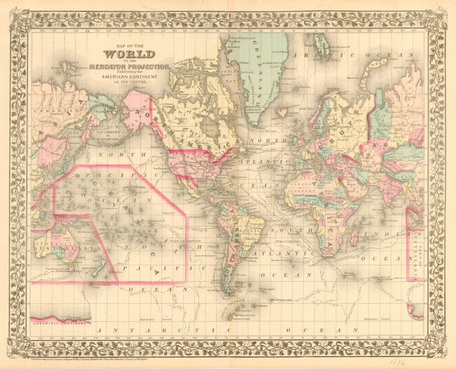
1) Map of the World on the Mercator Projection, Exhibiting the American Continent As Its Centre. Shows transatlantic telegraph cables and the tracks of famous explorers. S. A. Mitchell, 1876, hand color. (18 x 14.2") on verso, "Map of North America" and "Eastern Hemisphere" (10.6 x 13.5"). A few edge tears. Grade A.
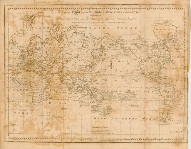
2) A General Chart of the World on Mercator's Projection exhibiting all the New Discoveries and the Tracks of the different Circum Navigators Engraved for Spotswood's & Nancrede's Edition of Malham's Naval Gazeteer. Shows the tracks of several British ships. London, 1797, b/w. (17 x 13"). Foxed and toned. Right margin trimmed to neatline. Grade C.
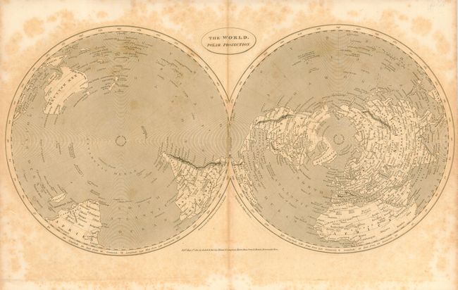
3) The World. Polar Projection. Finely engraved and detailed maps with no sign of Antarctica. Cadell & Davies…, London, 1811, b/w. (15.5 x 8"). Heavily foxed. Grade C.
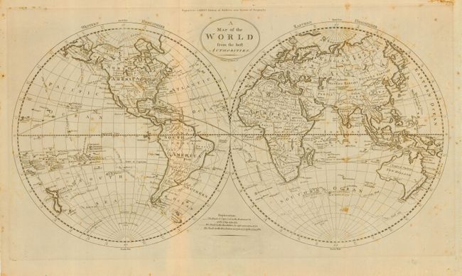
4) A Map of the World from the best Authorities for Carey's Edition of Guthrie's New System of Geography, circa 1795. Shows the tracks of Capt.. Cook in his ships Endeavour and Resolution. b/w. (20 x 11.5"). Foxed and toned, mostly along folds and edges. Grade B.
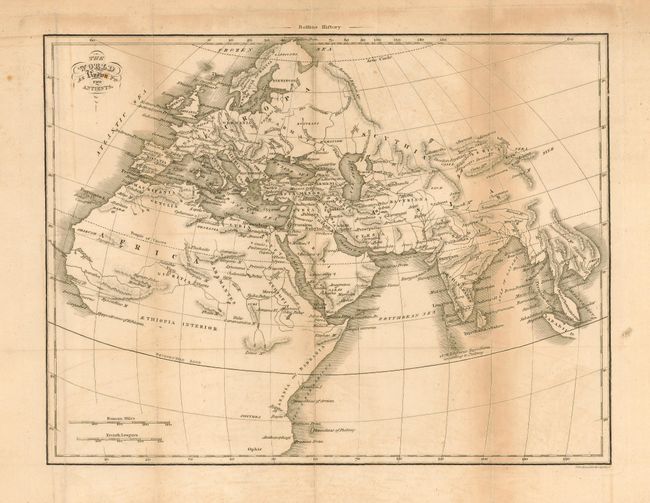
5) The World As Known To The Antients printed for Rollins History, circa 1800. A note locates "1378 islands near Toprobana according to Ptolemy". b/w. (12 x 9"). Several small spots. Toned along folds and edges. Grade B.
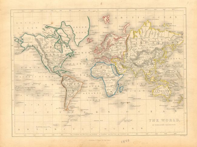
6) The World on Mercator's Projection . Shows discoveries of Graham's Land and Enderby's Land in 1832. G. Virtue, London, 1848, outline color. (9.3 x 6.8"). Toned along edges and a couple small spots. Grade B+.
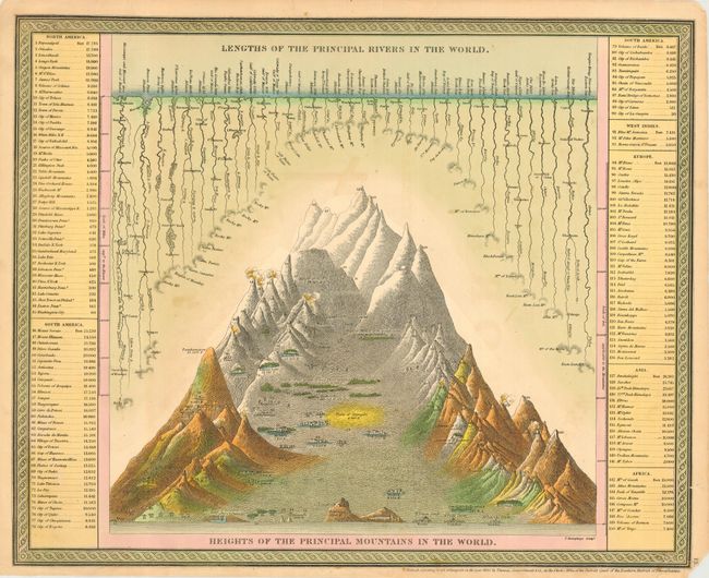
7) Lengths of the Principal Rivers / Mountains in the World. Comparison of the heights of mountains and lengths of rivers. Thomas, Cowperthwait & Co., Philadelphia, 1850, hand color. (16 x 13"). Some soiling. Lower right corner with a bit of loss in margin. Grade B+.
References:
Condition:
See individual descriptions.