Subject: Atlases
Period: 1806 (circa)
Publication:
Color: Hand Color
Size:
10.3 x 12.5 inches
26.2 x 31.8 cm
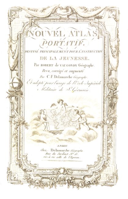
Complete with engraved title page and 53 maps as per the table of contents. Includes four world maps (showing the tracks of explorers including Capt. Cook), five related to the Americas, three of Africa, five of Asia, four of the Holy Land and the balance of Europe. The North American map (L'Amerique) includes a large inset showing the Sea of the West and a great Northwest Passage. Other maps of Americas include: Canada, Louisiane, Etats-Unis; and Nouvelle Espangne, Nouveau Mexicque, Isles Antilles. Maps are in original outline color. A beautifully engraved title page is followed by 9 preliminary pages that include a list of maps and an alphabetical index of place names. 4to. Complete. Rebound in marbled boards and quarter calf spine and tips. A very handsome example.
References: Pedley, p. 230.
Condition: A
Text and maps very good. Some occasional marginal foxing, rarely entering map. Binding as new. All in all an excellent example of this much sought after atlas.