Subject: Atlases
Period: 1791 (published)
Publication:
Color: Black & White
Size:
8 x 10.5 inches
20.3 x 26.7 cm
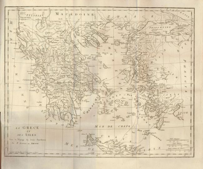
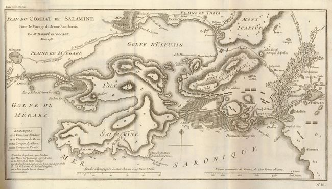
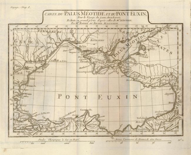
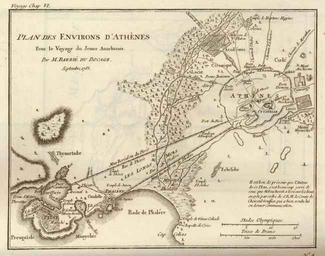
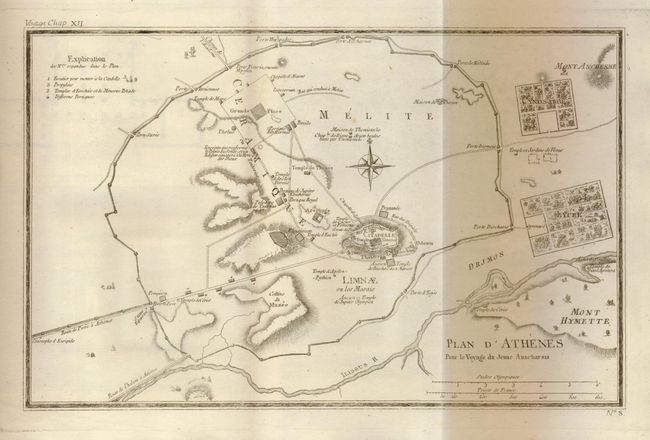
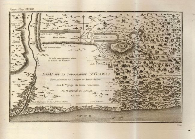
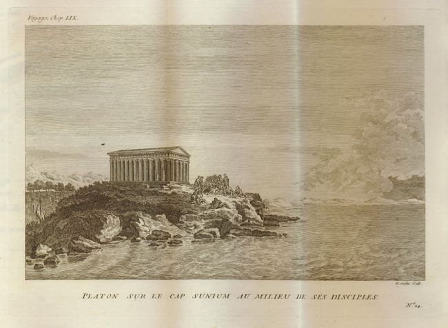
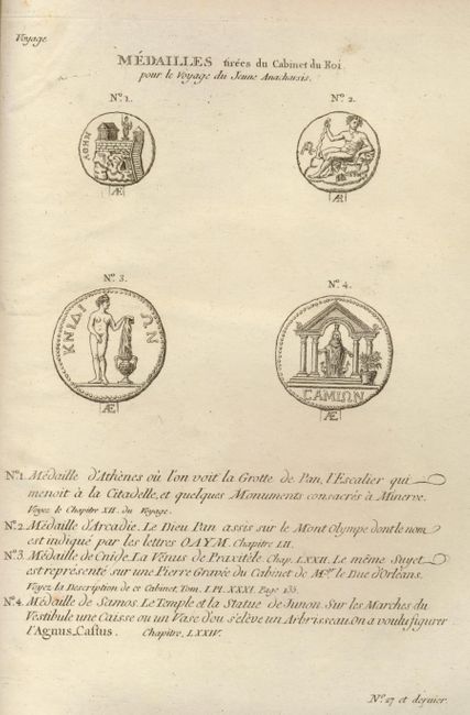
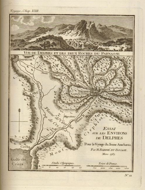
This terrific and difficult to find historical French atlas focuses on Ancient Greece and contains a total of 31 plates that document that famous civilization. Of the plates, 17 are maps (11 folding), and 12 are plans (5 folding). Additionally, there is a lovely, wood engraved view of Plato and his disciples at the Temple at the Cape Sunion, and another plate showing medallions. Of particular interest is the Plan du Combat de Salamine depicting the battle in 480 B.C. between Greece and Persia in the Aegean Sea. Another plate, Essai Sur La Topographie d'Olympie shows the layout of the location where the first Olympic games were held. 8vo. Complete with original hardbound brown paper covered boards with quarter calf spine and tips.
References:
Condition: B
Text and maps very good with bright and crisp impressions. Several plates have small fold separations. Covers are sun faded and shelf worn, corners are lightly bumped. Spine is missing its calfskin cover. Hinges and binding are loosening, but still sound.