Subject: Philippines
Period: 1750 (circa)
Publication:
Color: Hand Color
Size:
16.5 x 21 inches
41.9 x 53.3 cm
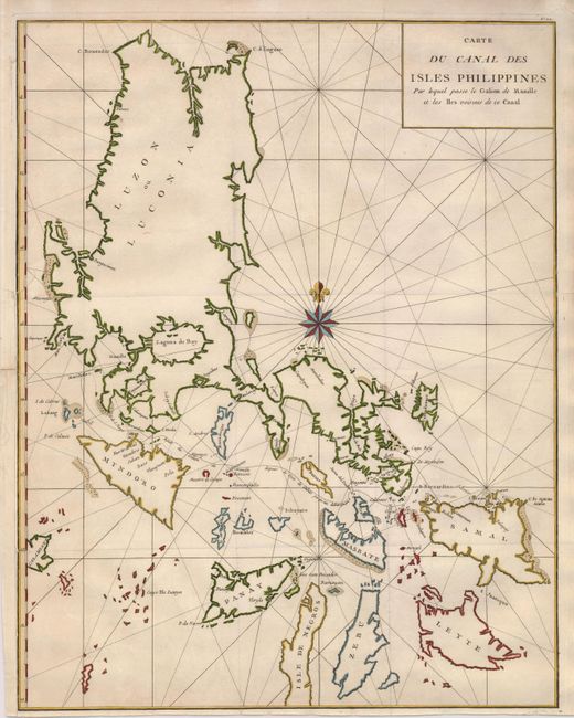
A large chart of the Philippines from Anson's account of his circumnavigation, one of the last great buccaneering voyages. This map shows the route of the treasure-laden galleon from Manila to the point just past Cape Espiritu Santo where she was taken by Anson. The chart is centered on a dramatic compass rose.
In 1740 Anson set sail in command of a squadron sent to attack Spanish possessions and interests in South America. The expedition was ill-equipped and failed to carry out its original ambitious mission. By June 1741 when Anson reached Juan Fernandes, his force had been reduced to only three of the original six ships, while the strength of his crews had fallen from 961 to 335. After recuperating on the island he collected the remaining survivors on his flagship, the Centurion, and set sail in search of one of the richly laden galleons that conducted the trade between Mexico and the Philippines. The indomitable perseverance he had shown during one of the most arduous voyages the history of sea adventure gained the reward of the capture of an immensely rich prize, the Nuestra Señora de Covadonga, which he encountered off Cape Espiritu Santo on June 20, 1743.
References:
Condition: B+
Sharp impression with folds as issued. The map is remargined to the neatline on the lower left binding side, also repairing a small tear just into the border. The right margin has a short fold separation, just touching the neatline.