Subject: Asia
Period: 1830 (circa)
Publication:
Color: Black & White
Size:
28 x 22 inches
71.1 x 55.9 cm
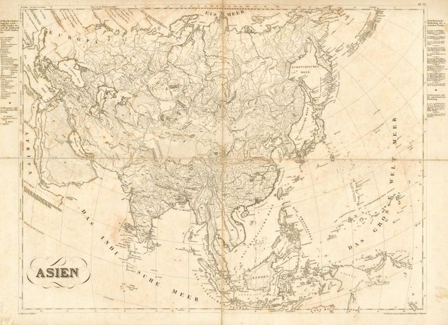
This very large, finely engraved and detailed copper plate map covers all of Asia. It is segmented and mounted on original linen. It stretches from the Red Sea to the Aleutian Chain in Alaska and south to show all of the East Indies (Indonesia) and Papua New Guinea. The map is remarkably detailed with much topographical and watershed information presented. Also shows lakes, deserts, villages and towns, trade routes and trails, and much more. Various island chains in the South Pacific are detailed including New Caledonia, the Bismarck Archipelago, the Caroline Islands, etc. With many place names such as Batavia, Schudia, Madras, Alexandria, Tobalsk, and Peking. The political divisions are noted and identified in an index at left outside the neat line. Von Schlieben's maps are normally seen in a much smaller size, making this issue uncommon.
References:
Condition: B
Crisp, dark impression. Overall foxing, else no flaws.