Subject: Balkans
Period: 1688 (dated)
Publication:
Color: Hand Color
Size:
23.5 x 17.8 inches
59.7 x 45.2 cm
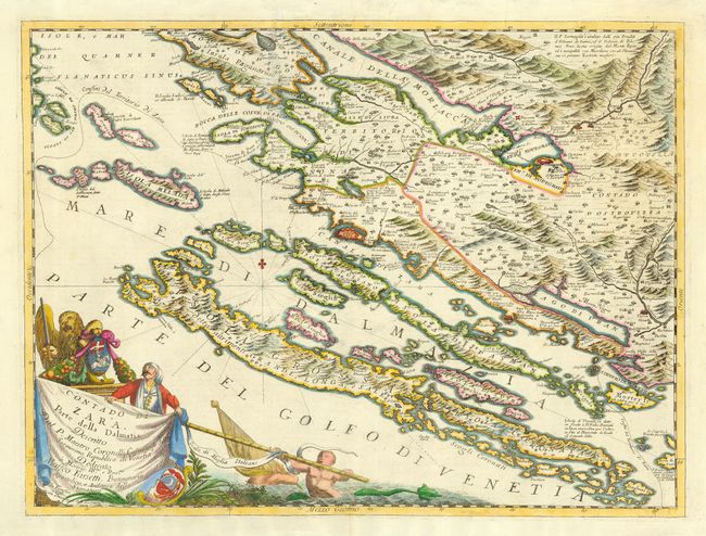
This map is a splendid example of Coronelli's style with the topographical features graphically depicted and the elaborate cartouche filling the unengraved portion of the map. The map covers the Dalmatian coastline and the adjacent islands that now form the Kornati National Park. The large fortification at Zara (Zadar) is prominently depicted. Coronelli established the society of geographers "Accademia degli Argonauta", one of the oldest in the world, and became the official geographer of the Venetian Republic. His maps of the Adriatic Sea were of particular strategic and economic importance and were also often used to glorify Venice and its victories over the Turks. Italian text on verso.
References:
Condition: B
There is a minor repair of paper weakness just left of centerfold at top, else very good.