Subject: Germany
Period: 1730 (circa)
Publication:
Color: Hand Color
Size:
17.5 x 19 inches
44.5 x 48.3 cm
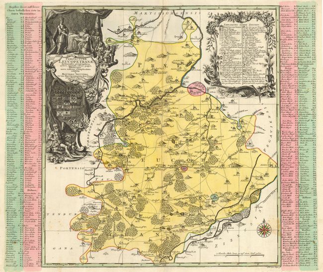
Detailed map centered on Weissenfels in the Sachsen-Anhalt region of Germany, bounded by the town of Lutzkewitz in the east, Stohsen in the west and Droysig in the south. The map is illuminated by a stunning cartouche with a queen's coronation attended by a host of cupids on the top and Father Time on the bottom. The explanatory table is festooned with plants, shells and tools of agriculture. There is also a very beautiful compass rose in the corner.
References:
Condition: B
A dark impression with a couple of minor stains. The backstrap has been removed, leaving thin paper and one tiny hole along the centerfold that has been reinforced with archival tape.