Subject: France
Period: 1635 (circa)
Publication:
Color: Hand Color
Size:
19.5 x 15 inches
49.5 x 38.1 cm
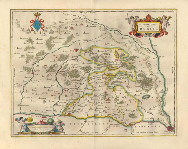
This very attractive 17th century map depicts the Dombes region in southeastern France. The ancient city of Lyon, for centuries an important textile center, is found in the lower right corner. The area between Lyon and Macon, west of the Rhone River, is an important Beaujolais wine region. Most cities, towns, forests and waterways are identified. The beautiful title and scale cartouches and elaborate coat-of-arms further enhance the map. The distance scale cartouche features putti, a globe, and armillary sphere. Imprint of Willem and Johannes Blaeu at lower right. German text on verso.
References:
Condition: A+
Fine impression with original color and wide original margins. There is a hint of foxing in blank margins, still fine.