Subject: London, England
Period: 1888 (dated)
Publication:
Color: Printed Color
Size:
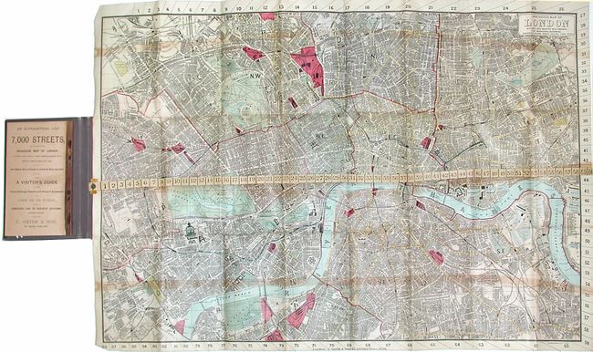
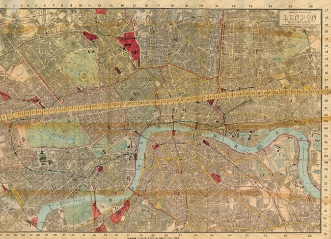
29 x 19 inches
73.7 x 48.3 cm
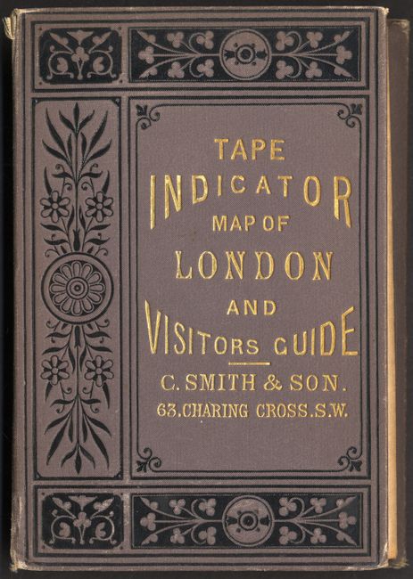
A very detailed and unusual folding pocket map with a built-in tape measure attached at left for measuring distances throughout the city in quarter mile segments. Covers from West Kensington to Deptford in the south and from Kilburn to Hackney in the north. This unique folding map uses a fixed numbered tape and numbers on the map edge to find locations using the street index. This example is Linen-backed, and folds into embossed gray cloth covered boards with black decorative touches and gilt title. A 55 pp. Visitor's Guide contains everything the visitor to London needed to navigate the city, including a formula for figuring cab fares
References:
Condition: B
Map is stained along the areas of contact with the attached ruler. Linen backing is toned along the folds. Street index with some chipping along the lower margins of several pages. Covers a bit shelf worn with the front board separated from the binding of the index. Still in nice shape for its age.