Subject: Brazil
Period: 1825 (published)
Publication:
Color: Hand Color
Size:
11 x 11 inches
27.9 x 27.9 cm
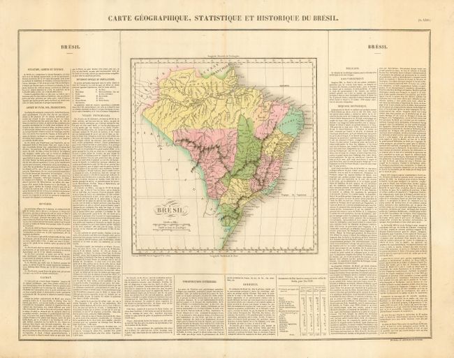
This attractive, copper engraved map details Brazil's extensive watershed, topography, towns and villages and coastal information. On three sides French text describes the country, its history, production and commerce, rivers, principle settlements, etc. A table compares the imports and exports of Rio Janeiro and Bahia to various parts of the world. The size given is for the map only; it is on a large folio sheet measuring 26" x 20". The map was originally engraved by Young & Delleker in 1822. Buchon produced the French edition of Carey & Lea's American Atlas. He used a better quality paper and today his maps are generally found in better condition than their American counterparts.
References:
Condition: A
Beautiful original coloring and impression on a full sheet with full margins. Just a trace of toning at centerfold, still very good.