Subject: Jamaica
Period: 1764 (published)
Publication: Le Petit Atlas Maritime
Color: Hand Color
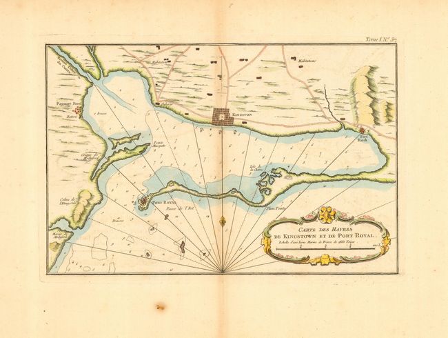
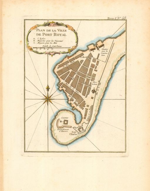
These two important maps depict Kingston's harbor. The first chart (double-page, 11.8 x 7.6") shows Kingston and Port Royal as block city plans, the forts Passage and Rock, roads and habitations, numerous soundings, and more. It is embellished with a rococo-style cartouche, rhumb lines and a fleur-de-lys. The second chart (6 x 7.7") is a close-up plan of Port Royal with Ft. Charles controlling the entrance. Details include names of individual streets and important buildings. A rococo-style cartouche, rhumb lines, compass rose with a fleur-de-lys adorn the design.
References: 1) Sellers & Van Ee 1952; 2) Sellers & Van Ee #1951
Condition: B
Both are on a full sheet of thick hand-laid paper with original margins. The first is lightly toned along centerfold, spot in margin; the second is a very good example.