Subject: Cuba
Period: 1564 (circa)
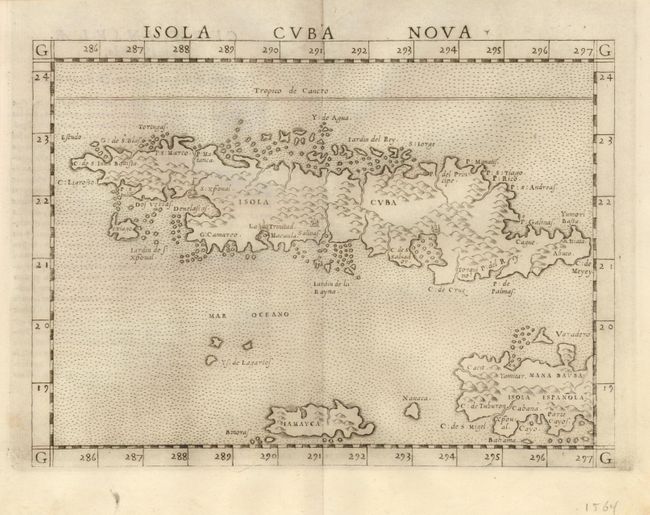
Publication: La Geografia de Claudio Tolomeo Allessadrino…
Color: Black & White
Size:
9.5 x 7 inches
24.1 x 17.8 cm
This is a very early, detailed map of Cuba, based on the work of Gastaldi. Cuba is correctly shown as a very mountainous island, although the overall shape and orientation is incorrect. Trinidad (La Trinitad) appears in its correct position on the southern coast, but the other cities are less identifiable. The map also includes Jamaica, the Caymans and part of Hispaniola. This map is from one of the early editions as it was printed on a shared plate with another map, as attested by the fact that the top portion of the plate mark runs off the page. The plate was trimmed down for later editions.
References:
Condition: A+