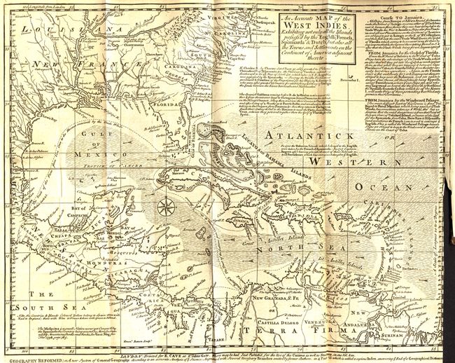
Subject: Gulf of Mexico and Caribbean
Period: 1740 (dated)
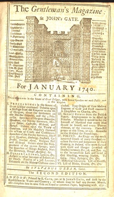
Publication: Gentleman's Magazine
Color: Black & White
Size:
14.5 x 11.5 inches
36.8 x 29.2 cm
A handsome and fully engraved map covering the Southern U.S., Central America, the West Indies and northern South America. It presents a fascinating configuration of Florida as wedge-shaped with a flat bottom. The chart is covered with interesting notations concerning the history of the region, territorial claims, and the Spanish gold fleet. Extensive trade-wind arrows and a compass rose fill the seas. A long notation gives sailing directions from Europe, Africa, Florida to Jamaica, and from Jamaica to the Windward Passage. Complete and still bound with the original Gentleman's Magazine, January 1740. Interesting magazine with a report on the Senate of Lilliput, which are in fact a report of the debates in Parliament, which were forbidden to be published or reported. The writer simply twisted the names slightly and published them under this guise. Included is an elegy to Irish who died during the first potato famine of 1739-40.
References: Jolly GENT-6; Sellers & Van Ee #1681.
Condition: B
Lovely impression. The binding trim is close to the neatline and there is a short binding tear into the border at right.