Subject: California and Baja Mexico
Period: 1868 (dated)
Publication:
Color: Black & White
Size:
40 x 49 inches
101.6 x 124.5 cm
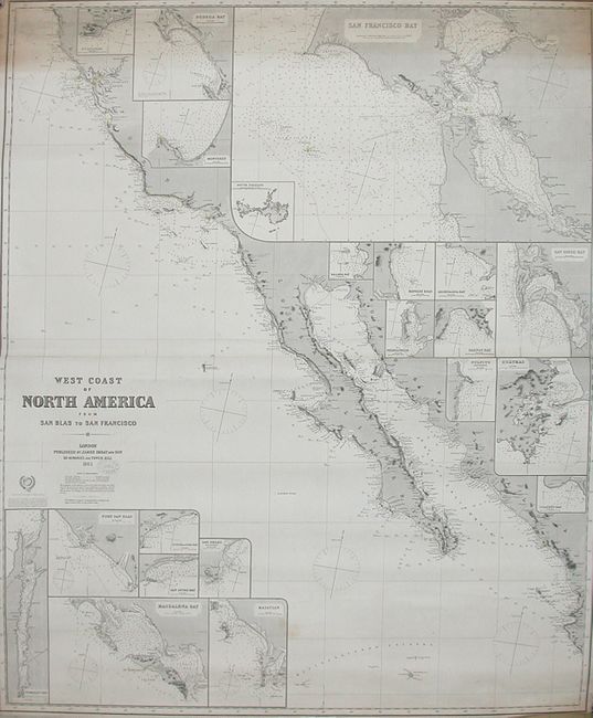
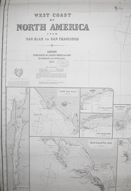
Striking blue-backed, working sea chart showing the coastal area from Point Delgado (Point Arena) near Mendocino down to Perula Bay at the tip of the Baja Peninsula. The map is inset with smaller charts of bays and ports along the route, including: Santa Barbara, Bodega Bay, Monterey, San Francisco Bay with South Farallon Island, Balena Bay, Mangles Road, Amortajada Bay, Pichilingue, Salinas Bay, Pulpito, San Diego Bay, Guaymas, Port San Blas, San Jose del Cabo Bay, San Lucas Bay, San Pedro, Magdalena Bay, Mazatlan, Socorro Island and Tomales Bay, an estuary near San Francisco. The map is copper engraved and has hand colored lighthouses along the coastal areas, with numerous compasses, soundings and other sailing information. Published by Imray & Son in London, who stamped it 1884 near the title in blue ink. This firm exists today as Imray, Laurie, Norie & Wilson Ltd, still specializing in nautical charts.
References:
Condition: B
Apart from one light stains and one area of irregular toning at the top right corner and a 2" tear at bottom, this map is very good to fine.