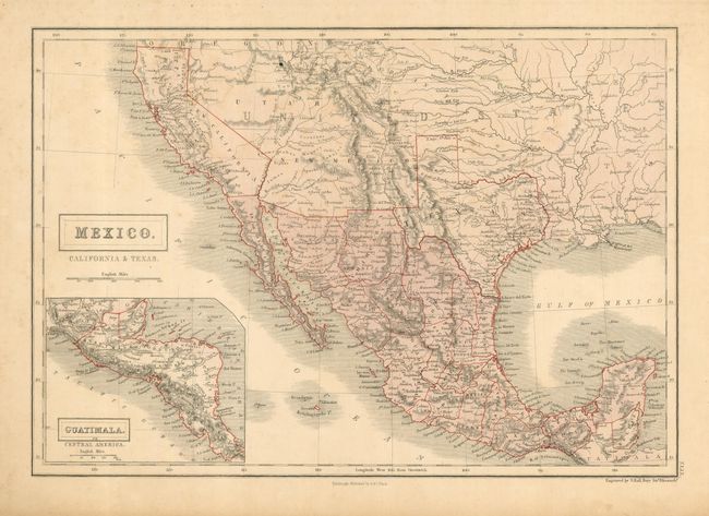
Subject: United States & Mexico, California, Texas
Period: 1857 (circa)
Publication: Black's General Atlas
Color: Printed Color
Size:
14.8 x 10.3 inches
37.6 x 26.2 cm
This delicately engraved map depicts Mexico and the region recently acquired by the United States in the Mexican/American War. The map features a post-Gadsden Purchase border between Mexico and the United States. Californian missions dot the route along the coast into Baja. Detail throughout the Southwest and Texas includes forts, roads, towns. The huge Utah Territory stretches between California and Indian Territory. New Mexico Territory is in its largest extent, bounded by Mexico, California, Utah and Texas. The inset map of Central America is titled Guatimala. This lithographed map is a nice example of the combination of early printed color (Mexico) and outline color applied by hand on the boundaries. Finely engraved by Sidney Hall.
References:
Condition: B
Good impression with full original margins. The map has a short tear in upper blank margin and a hint of toning mostly in left side. Ink spot at the Great Salt Lake.