Subject: Virginia
Period: 1861 (dated)
Publication:
Color: Hand Color
Size:
47.3 x 30.3 inches
120.1 x 77 cm
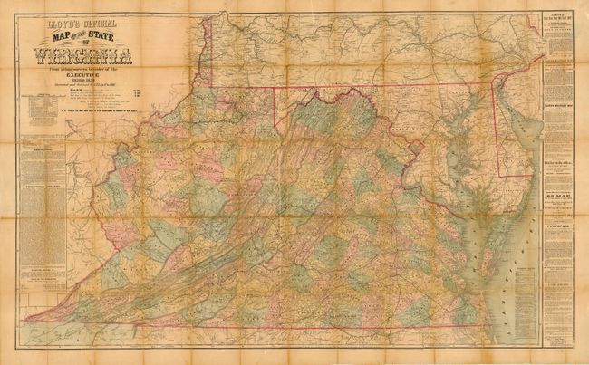
Scarce, large-scale dissected folding map of Virginia during the Civil War, based on Herman Boye's even larger nine-sheet map of 1827. The map is filled with detail of towns, counties, topography and roads, all on a scale of 1 mile to 10 inches. The text shows promotional material related to this map and others that the company made, as well as a nota bene under the title mentioning that 'This is the only map used to plan campaigns in Virginia by Gen. Scott.' Scott was a renowned Union general, though quite elderly at the time of the Civil War. He passed command to Maj. Gen. George B. McClellan in 1861, and versions of this map after 1861 note General McClellan instead of Scott. The text also notes the variety of ways this map can be prepared, from wall maps to folding maps. Quite a fascinating document that folds down to (5.5 x 7").
References: Phillips (M) p. 988; Phillips (VA) p.72.
Condition: B
Dissected and linen backed, missing its covers. The map has some separations on the folds and a few areas of flaking and loss. There is some archival tape on the verso.