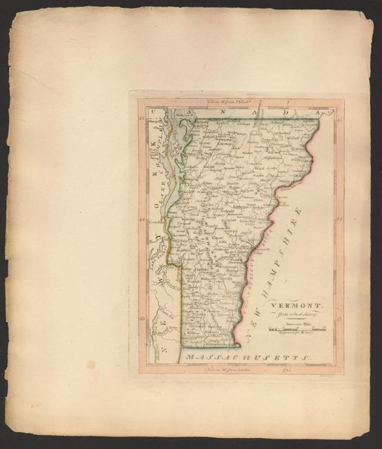
Subject: Vermont
Period: 1815 (circa)
Publication: American Atlas
Color: Hand Color
Size:
5.7 x 7.7 inches
14.5 x 19.6 cm
Carey's well rendered map of Vermont is filled with place names and shows the locations of mountains, rivers and the major roads. This example also notes the locations of Ticonderoga, and Dartmouth College. Along the Connecticut River are the locations of Fifteen Miles Falls and the Great Oxbow Bends. The current capital, Montpelier, is not yet shown. Vermont had existed as an independent republic since 1777, and, after paying New York State $30,000, it was admitted into the Union as the fourteenth state in 1791.
References:
Condition: A
Clean example with original hand coloring on sheet with very wide margins. Left edge of paper is deckled with a little roughness and a narrow line of toning at edge.