Subject: Texas
Period: 1899 (dated)
Publication: USGS Bulletin 190
Color: Printed Color
Size:
35.5 x 31 inches
90.2 x 78.7 cm
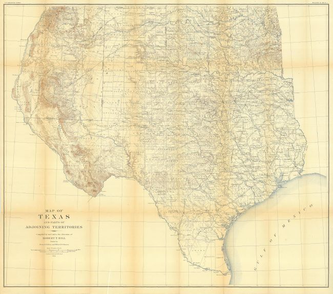
A large and extremely detailed map of the state that also covers most of Oklahoma and New Mexico east of the Rio Grande and south of Taos. The details include counties, county seats, railroads, topographical and watershed with contours at 250' intervals. This map, by Robert T. Hill, a widely known scholar, teacher and geologist, brought new sophistication to Texas cartography and helped set new scientific standards for the region's cartography. It was published in USGS Bulletin #190 - A Gazetteer of Texas and Topographical Atlas of the U.S., Physical geography of the Texas Region.
References:
Condition: B
Folding, as issued, with light toning on folds and a few intersection splits. A 4-1/2" binding tear is repaired with archival tape.