Catalog Archive
Auction 119, Lot 338

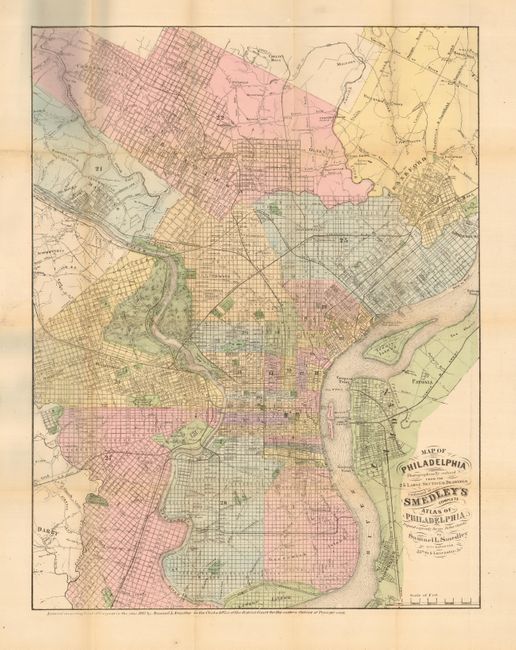
"Map of Philadelphia Photographically Reduced from the 25 Large Sectional Drawings Contained in Smedley's Complete Atlas of Philadelphia", Smedley, Samuel L.

Subject: Pennsylvania, Philadelphia

Period: 1861 (dated)

Publication:

Color: Hand Color

Size:
15 x 19.5 inches
38.1 x 49.5 cm
Download High Resolution Image
(or just click on image to launch the Zoom viewer)

Unusual, and very scarce pocket edition of this map. Absolutely filled with details of streets, buildings, open spaces, railroads, and more. Extends to include the communities of Darby, Haddington, Hestonville, Chestnut Hill, Camden, Frankford, and more. Map folds into black cloth covers (4 x 6") with gilt title "New Map of Philadelphia."

References:

Condition: B

Several small intersectional fold separations and a short binding tear just entering map, repaired with archival tape. Covers have just a hint of wear.

Estimate: $350 - $450

Sold for: $250

Closed on 5/9/2007

Archived