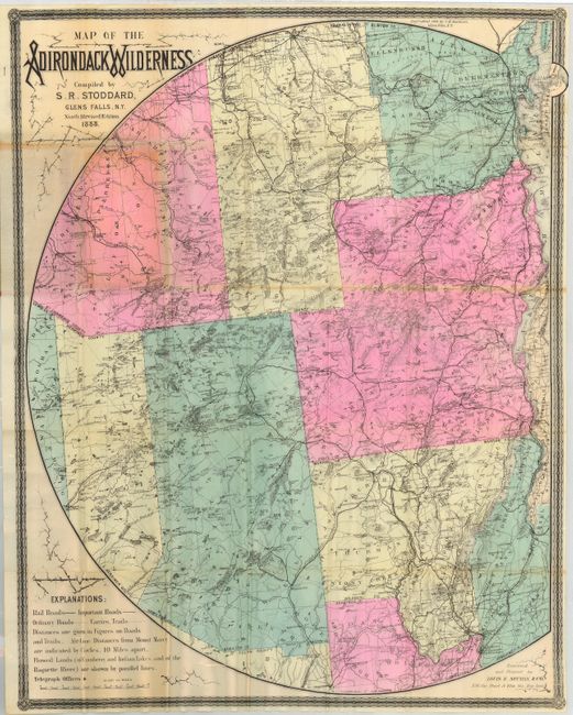
Subject: New York
Period: 1888 (dated)
Publication:
Color: Hand Color
Size:
25 x 31.5 inches
63.5 x 80 cm
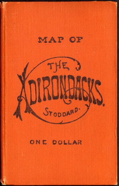
Detailed and brightly colored pocket map of upstate New York. The map extends from the eastern edge of Lewis county all the way to Lake Champlain in the east, south to show part of Saratoga and Fulton counties, and north to include Franklin, Clinton and St. Lawrence counties. The map has good detail throughout including political boundaries, towns and villages, roads, railroads, lakes, watershed, and topography. The map folds into 4.3" x 6.8" stamped orange cloth covers. This 9th (revised) edition was compiled by S.R. Stoddard of Glens Falls, N.Y., engraved and printed by Louis E. Neuman, & Co., of New York City. Surrounded by decorative border, blank on verso. Paste-down on inside front cover lists testimonials from other authors.
References:
Condition: B
Map has several intersectional fold separations, and a fold separation where it is attached to the boards. Overall bright and crisp with near fine covers with minimal shelf wear.