Subject: New York, Buffalo
Period: 1850-55 (circa)
Publication:
Color:
Uncommon set of maps that feature Buffalo, New York at the middle of the 19th century.
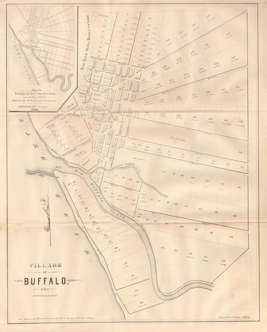
1) Village of Buffalo. Lith. of Richd. H. Pease, ca. 1850, from "Maps in the Offices of Secretary of State & Surveyor General, Albany," uncolored, 15.8" x 20". This map is a close-in detail of the original village centered on the confluence of Big Buffalo Creek at Lake Erie. The plan shows streets, and major subdivisions with lot size. Locates the Public Square and New York State Reservation. Inset with a "Map of the Village of New Amsterdam," as it was originally surveyed and laid out for the Holland Land Company in 1804 by Joseph Ellicott. The plan is quite similar to the present-day downtown area.
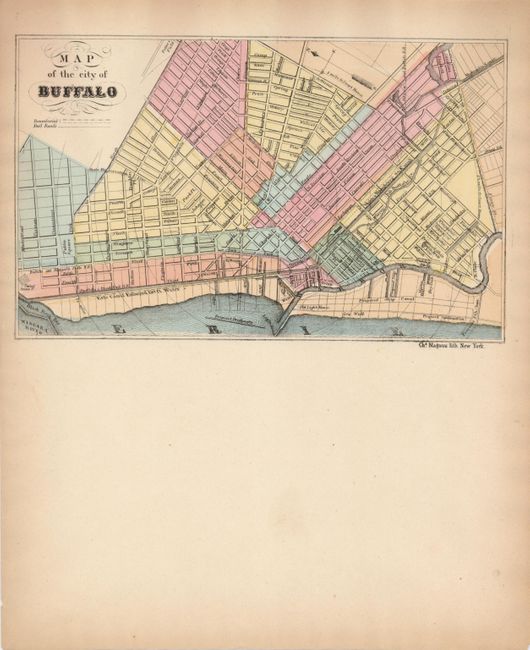
2) Map of the City of Buffaloby Chs. Magnus, ca. 1855. It is hand colored and measures 7.8" x 4.8". This plan of Buffalo shows a slightly larger view than the first map. It extends to the north to show the beginning of the Erie Canal at Black Rock Bar, and south to name streets St. Clair, Ferry, Abbot Rd, and more. Locates the Proposed Ship Canal, Old Light House, the Buffalo and Niagara Falls R.R., Hydraulic Canal, and more. All streets are named. The map features circular distance lines from the Court House. This issues is printed on the top half of a four-page letter sheet with the other pages blank, perhaps a proof printing.
References:
Condition:
1) Folding, as issued. It is very good to good with just a little foxing at sides of lower fold and a hint of text offsetting at bottom right. 2) Fine with a little age toning on blank sheets.