Subject: Cape Cod, Massachusetts
Period: 1902 (dated)
Publication:
Color: Printed Color
Size:
27 x 30.5 inches
68.6 x 77.5 cm
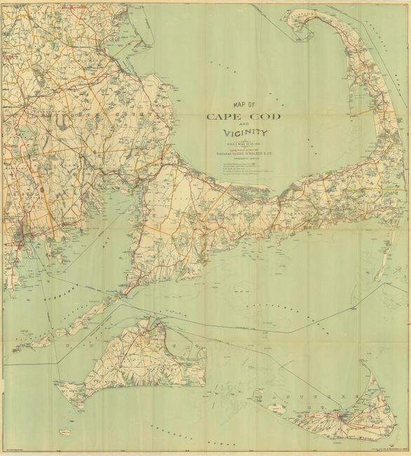
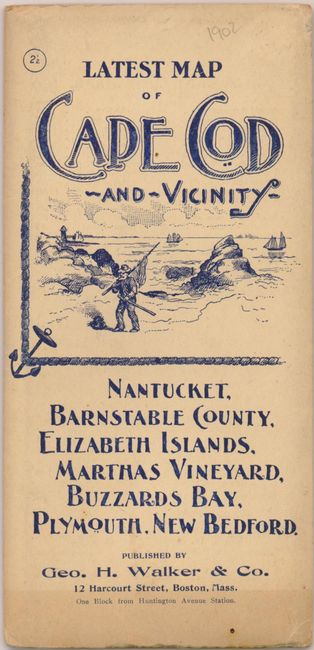
This large pocket map includes "Cycling Routes shown in Red" and folds into pictorial wrappers, 4 x 8". Well detailed on a scale of 2 miles to an inch, the map includes all of Cape Cod, Nantucket and Martha's Vineyard. Extends west to show New Bedford, Mattapoisett, Marion, East Bridgewater, and the southern portion of Whitman. Excellent details of roads, villages, harbors and ports, steam ship tracks, and much more. Cycling routes are highlighted in overprinted red. The legend locates railroads and stations, the "best" roads, and water depth contour lines. Folds into pictorial cover with blue printing that features a nautical image on the cover. The inside and back cover provide a long list of all pocket city and railroad maps sold by Geo. H. Walker & Co. A very nice example of this uncommon pocket map.
References:
Condition: A
Map is fine less a few small fold intersection splits. Covers are near fine less some edge toning and a slightly darker strip of toning along the bottom, and a small abrasion on back where price sticker was removed.