Subject: Massachusetts, Springfield
Period: 1885 (dated)
Publication:
Color: Black & White
Size:
19.8 x 18.5 inches
50.3 x 47 cm
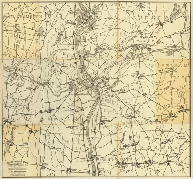
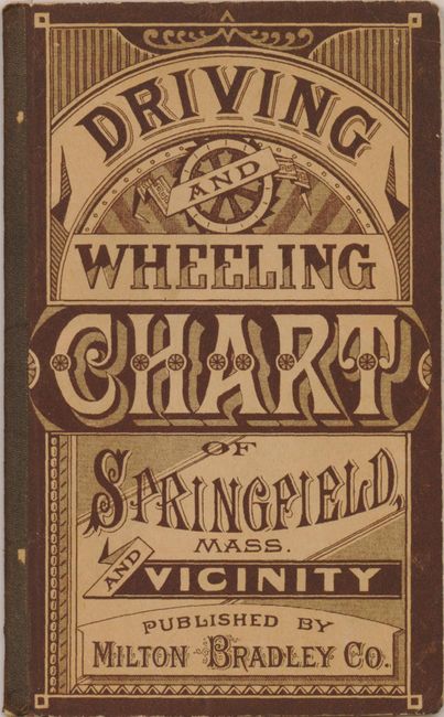
This is a scarce, if not unrecorded pocket map by the Milton Bradley Company. The simple folding map shows the vicinity of Springfield extending to the Springfield Reservoir in the northeast, Westfield to the west and Woodville in the southeast. Details all roads and trails, villages, railroads, towns, and watershed. Some individual buildings are noted. Locates East Farms, Southwick Ponds, a woolen mill, Mt. Vision and more. The map folds into pictorial wrappers with explanatory tour information on the inside. The cover is beautifully rendered with fancy designs and lettering. On the back cover are ads for the Charles Hall Crockery &c. Company, and W.S. Clark & Company, Hats and Men's Furnishings, both in Springfield. The Milton Bradley Company was based in Springfield so one can image this as a very limited local project for the company. A most rare issue.
References:
Condition: B
The map has two panels with light toning and one fold reinforced on verso with archival tape, else very good. The covers are in remarkable, nearly unused condition.