Subject: Hawaii
Period: 1919 (dated)
Publication:
Color: Printed Color
Size:
32.8 x 21.8 inches
83.3 x 55.4 cm
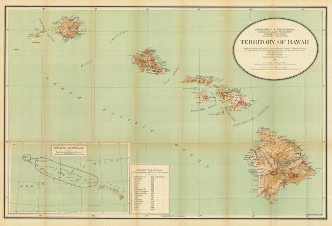
This is a large and colorful map that was "compiled from data on file in the U.S. Coast and Geodetic Survey; U.S. Geological Survey; Hydrographic Office: Hawaiian Government Surveys, and other authentic sources under the direction of I. P. Berthrong Chief of Drafting Division." It was published under the direction of the commissioner Clay Tallman. With a large inset (12.5 x 7.5") at lower left providing a wider view of the entire archipelago. It notes in red the Hawaiian Islands Bird Reservation. A table gives the distance to the principle ports in the Pacific Ocean from Honolulu. Good detail on a scale of 1 inch = 12 miles. This chart indicates that it is updated to 1919.
References:
Condition: A
Good color and full margins. Folding as issued with a hint of fold toning and a couple tiny fold intersection splits.