Subject: Hawaii
Period: 1906 (dated)
Publication:
Color: Printed Color
Size:
25 x 20 inches
63.5 x 50.8 cm
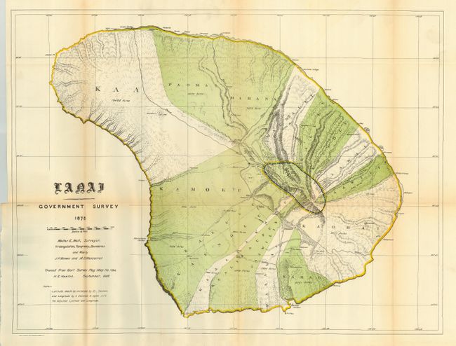
This map is a detailed and early survey of the island made under the direction of W.D. Alexander, Surveyor General of Hawaii Territory. Triangulation, topography and boundaries by J.F. Brown and M.D. Monsarrat. The island is divided into at least ten regions, all named and shown via color, with acreages given. Locates harbors, rocks, anchorages, school houses, villages, and peaks with elevations. A charming and unusual map of this beautiful island.
References:
Condition: A
Folding, as issued. Small marginal binding tear closed on verso. Apart from a little fold toning, a fine and bright example.