Subject: Hawaii
Period: 1903 (dated)
Publication:
Color: Printed Color
Size:
34 x 24 inches
86.4 x 61 cm
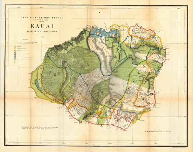
Brilliantly colored and detailed map of Kauai with much information on pineapple and sugar plantations, homesteads, public lands, swampland and unsurveyed areas. This very attractive example delineates public and private family holdings as well as rice fields, sugar plantations, roads, schools, forts and the location of a wireless telegraph pole. Hawaii's monarchy was overthrown in 1893, and this map was prepared for the Governor's Annual Report of 1906. The governor at this time was George R. Carter.
References:
Condition: A
Folding, as issued. Small marginal binding tear just into border professionally closed. Apart from a little fold toning, a fine and bright example.