Subject: United States - Southwestern
Period: 1865 (dated)
Publication: General Atlas
Color: Hand Color
Size:
26 x 16.7 inches
66 x 42.4 cm
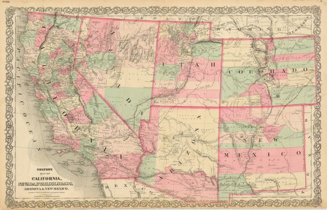
This is the uncommon Colton issue, likely published about 1867. It features the Pacific Railroad which is shown only partially completed through Wyoming with no work accomplished in Utah. Arizona Territory has it first four counties, namely Mohave, Yuma, Pima and Yavapai with Prescott as the capitol. New Mexico Territory retains its original 'strip' counties. The Utah/Nevada border is correctly at 114°, its final location. The Pony Express route is shown, as is the Mail Route. The map has exceptional information on railroads, both built and planned. It is filled with place names, information on topography and watershed, and numerous notes. For example, one note in west central Colorado states "Elevated plain, fertile, gently rolling with fresh water, lakes and timber." Fancy titling and decorative scroll-style border.
References: Wheat (TMW) #1200.
Condition: B
Fine original color and nice impression. Original margins that are narrow at bottom, as issued. Lightly toned along centerfold with split into map at bottom, closed on verso with careful repair. Some chips along upper margin, also repaired on verso.