Subject: United States - Northwestern
Period: 1859 (circa)
Publication:
Color: Hand Color
Size:
14 x 11 inches
35.6 x 27.9 cm
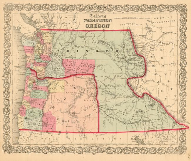
A terrific map of the Pacific Northwest that shows Washington Territory in its most unusual configuration as it wraps around the new state of Oregon. Of specific interest on the map is the notation of all the major exploration routes, wagon trails and the proposed routes for the transcontinental railways. This map was published by Johnson & Browning shortly after Oregon became a state in 1859. The organized counties of both Oregon and Washington are confined west of the mountain ranges except for Skamania and Walla Walla Counties. The map is surrounded by Colton's signature strapwork border, with the imprint of Johnson & Browning as publishers.
References:
Condition: A
Lovely original wash coloring.