Catalog Archive
Auction 119, Lot 223

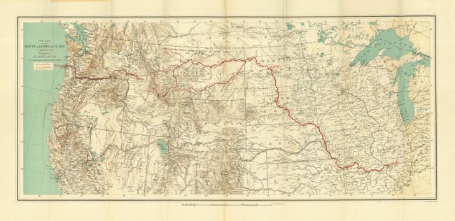
"New Map of the Route of Lewis and Clark in 1804-5-6. Prepared by Elliott Coues for Comparison with Clark's Map of 1814", Coues, Elliott

Subject: United States - Western

Period: 1893 (published)

Publication: History of the Expedition Under the Command of Lewis and Clark…

Color: Printed Color

Size:
27.5 x 12.3 inches
69.9 x 31.2 cm
Download High Resolution Image
(or just click on image to launch the Zoom viewer)

This finely engraved map covers the northern two-thirds of the United States from the Great Lakes to the Pacific Ocean. The various routes of Lewis and Clark are detailed in red overprinting with line styles to differential travel over land vs. by water. A finely lithographed map printed in color by Julius Bien. This is one of three large folding maps included in Volume IV of what is considered one of the best works on the expedition. Published in a limited edition of only 1,000 sets, this map is a scarce issue and a beautiful example.

References:

Condition: A+

Folding, as issued. Bright color and impression.

Estimate: $250 - $350

Sold for: $375

Closed on 5/9/2007

Archived