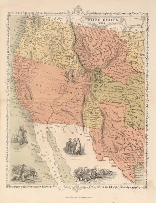
Subject: United States - Western
Period: 1850 (circa)
Publication: Penny School Series Atlas
Color: Hand Color
Size:
8 x 10 inches
20.3 x 25.4 cm
This uncommon map of the West has four vignettes: Indians; Mexicans; Gold Washing in California; and Santa Fe Traders Attacked by Indians. It is divided politically into Oregon, Upper California, Missouri Territory, Indian Territory, New Mexico and Texas. Texas is shown in an early, enlarged configuration. The Great Interior Basin is blank. Considering the obvious period of the map, the geography is quite inaccurate because Upper California encompasses all of California, Utah and most of New Mexico in the pre-Gadsden Boundary configuration. A quaint and delicate decorative border. Beneath border is "C. Montague Lithographer - 117 Cheapside, London, E.C." A curious little map from a scarce atlas.
References:
Condition: A
The map has good original color and dark impression. Two short marginal tears, closed on verso.