Subject: Kansas and Nebraska
Period: 1862 (dated)
Publication: H.R. Doc. 1, 37th Congress, 3rd Session
Color: Black & White
Size:
19.6 x 23.3 inches
49.8 x 59.2 cm
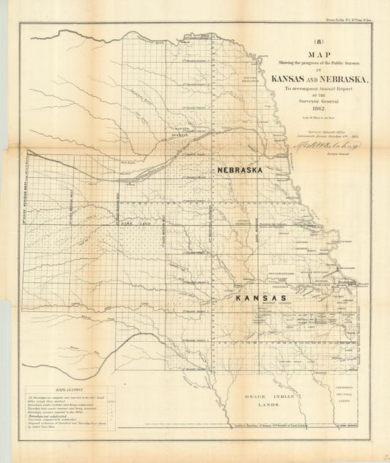
This is a great, early survey map covering the eastern portion of Kansas and Nebraska to 100° longitude. It clearly shows the surveying baseline, standard parallels, and guide meridians, plus many townships. This early example shows no counties or mineral information, and it pre-dates the railroad land grants. Instead, the various Indian Lands are delineated in great detail; the Omaha, Pawnee, Ottoe, Kickapoo, Sac & Fox, and Pottawattamie Reserves; the trust lands of the Sac and Fox, Peoria, Ottawas, and much more. The Cherokee Neutral Lands are located beneath Kansas along the Meosho River. Details include numerous towns, military lands, topography, and watershed. A legend gives the status of the township surveying: completed, under contract and being subdivided, surveying underway, not yet subdivided, plus a few other categories. Signed in the plate by Mark M. Delahay, Surveyor General. The territories were created by Congress in 1856 from an Unorganized Territory. In 1861, Kansas achieved statehood; Nebraska in 1867.
References:
Condition: B
Issued folding, this example has been backed with archival tissue. Sound paper with full margins. Toned along two folds, else very good.