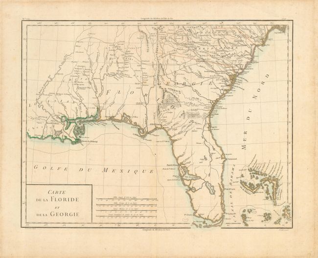
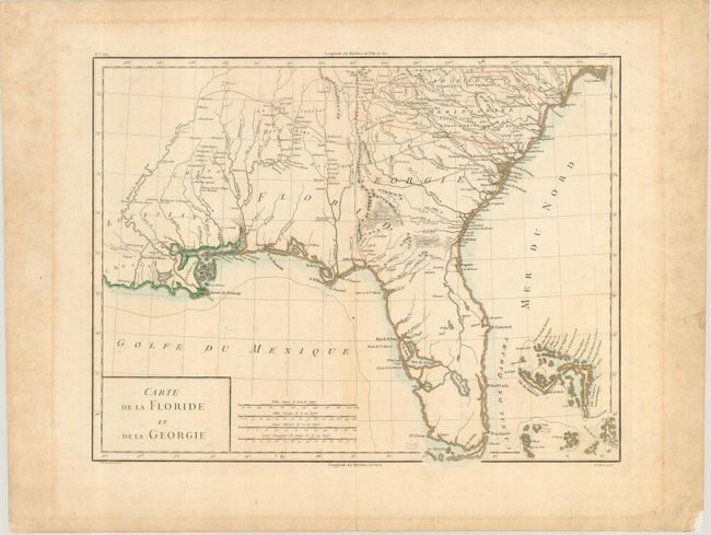
Subject: Southern United States
Period: 1785 (circa)
Publication:
Color: Hand Color
Size:
16.8 x 12.8 inches
42.7 x 32.5 cm
Handsome early map covering from South Carolina to Florida and through Louisiana. The map depicts Florida during the period when it was controlled by the Spanish. However, there are no engraved political divisions indicating the mapmaker's bias toward either the territorial claims of Spain or the United States. Numerous Indian villages are located and roads are shown connecting early settlements. There is a large Lac du St. Esprit linked with an oversized Baie du St. Esprit and Tampa Bay in Florida. The Bahamas are also well delineated.
References:
Condition: B
Lightly faded original outline color. Generous margins with some minor mat burn and a repair to the right lower corner, with no affect to the map itself.