Catalog Archive
Auction 119, Lot 194

"Virginiae partis australis, et Floridae parties orientalis, interjacentiumq regionum Nova Descriptio", Montanus, Arnoldus

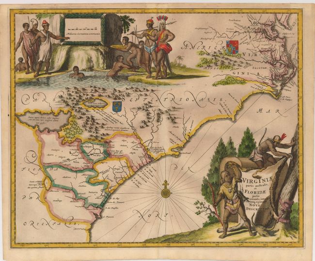
Subject: Colonial Southeast

Period: 1671 (published)

Publication: Die Nieuwe en Onbenkende Werld

Color: Hand Color

Size:
14 x 11.4 inches
35.6 x 29 cm
Download High Resolution Image
(or just click on image to launch the Zoom viewer)

This striking map of the Southeast shows the French and English claims in the region marked with their respective coats of arms. The cartography in the southern part of the map retains Le Moyne's three imaginary lakes, the largest draining through the Carolinas via the May River. While the map is nearly identical to the Blaeu/Jansson model on which it is based, the decorations are entirely original. The title cartouche is engraved onto a buffalo hide displayed by two Native Americans and at top is a large view that illustrates a group of natives panning for gold.

References: Burden #413; Cumming (SE) #67.

Condition: A

Sharp impression printed on fine paper with the jester watermark. Nice old color with pleasant toning. Brown paper hinge remnants on the verso.

Estimate: $1,200 - $1,500

Unsold

Closed on 5/9/2007

Archived