Subject: Southern United States - Mississippi
Period: 1804 (published)
Publication: New & Elegant General Atlas…
Color: Black & White
Size:
9.5 x 8 inches
24.1 x 20.3 cm
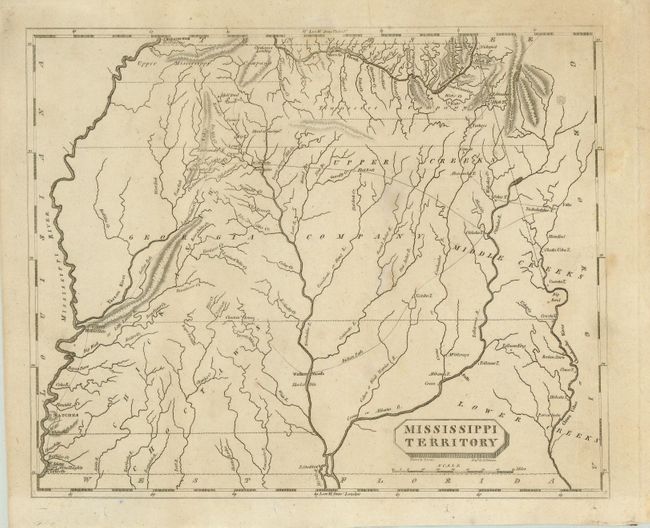
This is a small, but significant map of Mississippi Territory, covering the region of present-day Mississippi and Alabama. At the extreme northwest corner of the map is Fort Pickering on Chickasaw Bluff, near the future site of Memphis. Just below is a region labeled Upper Mississippi Company, and east of there, the Tennessee Company takes in the Tennessee River watershed in northern Alabama. Georgia Company occupies the middle of the map. Numerous Indian tribes and villages are located and Indian Paths, including the Natchez Trace are shown throughout. There are a number of forts located including Ft. Stoddert on the Mobile River, Ft. Adams on the Mississippi, and Ft. McHenry at Walnut Hills, later the site of Vicksburg. Drawn by Samuel Lewis and engraved by D. Fairman.
References: Phillips (A) #702-54.
Condition: B
Nice impression with a few light spots. There are small binding holes in the bottom margin, one of which affects the bottom right corner of the map.