Subject: Colonial Chesapeake Bay
Period: 1676 (circa)
Publication: A Prospect of the Most Famous Parts of the World
Color: Black & White
Size:
19.3 x 14.8 inches
49 x 37.6 cm
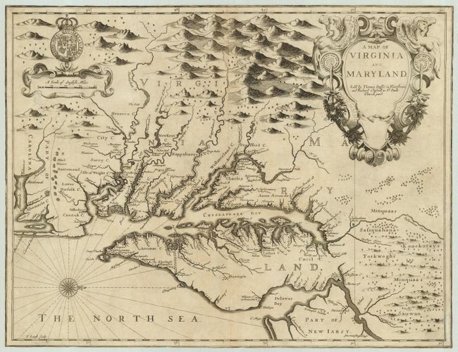
This famous map of the Chesapeake region is the last major derivative of John Smith's map of Virginia; but it is unique in that it also draws on the influential map by Augustine Herman of 1673 - thus becoming a transitional map between two important prototypes. The delineation of the land area follows Smith while the toponymic details are based on Herman. The plate was engraved by Francis Lamb in his vivid style with topography artistically depicted and large title and scale cartouches. Speed's atlas was the first world atlas produced wholly in England. It was first published in 1627 without any maps of the American colonies. It was not until the last edition (47 years after Speed's death), by Thomas Bassett and Richard Chiswell, that the new maps of America, engraved by Francis Lamb, were added. No text on verso.
References: Tooley (Amer) p.170, Derivative 9, state 1.
Condition: B
Map has been trimmed to neatline all around. There are a couple of old repairs of small punctures, one on centerfold and the other just inside the left border near <I>Musketo Inlet</I>.