Subject: Colonial Chesapeake Bay
Period: 1640 (circa)
Publication:
Color: Black & White
Size:
18.7 x 14.7 inches
47.5 x 37.3 cm
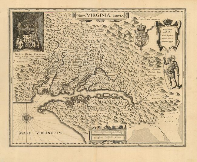
This is one of the most important seventeenth century maps of the Chesapeake Bay region. The map was derived from Capt. John Smith's map of 1612, which was the first to depict the bay and its tributaries with any accuracy. In the upper left corner is an engraving of the great Indian chief, Powhatan, seated on his throne and surrounded by his subjects. A Susquehanna chief is depicted on the right under the British coat-of-arms and a key cartouche. The plate was engraved by D. Grijp and originally published by Jodocus Hondius Jr. in 1618. It was purchased by Willem Blaeu shortly after Hondius' death (1629) and Bleau's imprint replaced that of Hondius. Latin text on verso with the last line, Africa D Minus, which is not recorded by Burden.
References: Burden #193.
Condition: A
Fine, dark impression printed on sturdy paper with wide original margins. There is light soil and an old fold repair in blank margins.