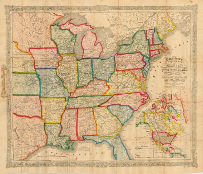
Subject: United States - Eastern
Period: 1856 (dated)
Publication:
Color: Hand Color
Size:
30.5 x 25 inches
77.5 x 63.5 cm
This scarce and brilliantly colored folding map covers the eastern half of the United States. The map was compiled by Fisher, who wrote the text for Colton's Atlas of the World (1855) and for many of Colton's gazetteers and guides. There is a wonderful inset of the continent of North America which is presented in the same brilliant color, and shows the continent extending to include a large portion of Greenland and a bit of South America. The map was issued in at least two other versions in 1856; one without the inset, and one with an inset of New York City. A very ornate border and very graphic title help make this map both an enjoyable and informative example.
References: cf Modelski #30.
Condition: B
The map has light, scattered foxing, a couple of small spots, the usual small fold separations, and a glue stain where the paper is adhered to the board. The covers are very good except for a small abrasion on the front cover.