Subject: United States - Eastern
Period: 1836 (dated)
Publication:
Color: Hand Color
Size:
19.8 x 19 inches
50.3 x 48.3 cm
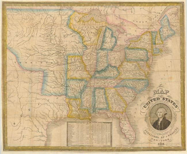
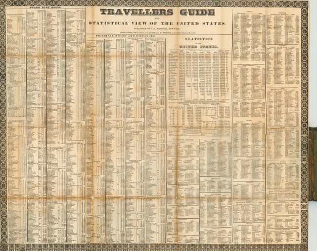
Scarce pocket map published by James Webster from Humphrey Phelps' plate of 1832. Phelp's name has been erased and Webster's has been added on the lower right. George Washington's portrait decorates this map along with a chart of the population of the United States in 1830. The map shows a large Missouri Territory reaching from Missouri and stretching to the Rocky Mountains. Wisconsin Territory is massive and includes the Upper Peninsula of Michigan and a portion of Minnesota. Arkansas gained statehood the year this map was published, but it is still shown as a territory. Texas is named as part of Mexico. Accompanied by the "Traveller's Guide and Statistical View of the United States" (21.6 x 17.7") in original pocket boards (3.5 x 5.3")
References:
Condition: B
Map issued folding into boards, now pressed and backed with heavy Japanese tissue to reinforce weak areas. Original light wash color with a couple of printer's creases at bottom.