Subject: United States - Eastern
Period: 1805 (circa)
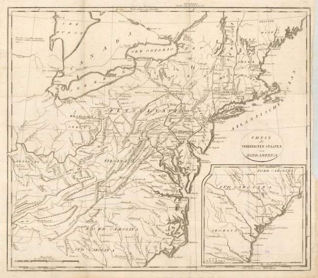
Publication: Reise durch die Staaten von Nordamerika
Color: Black & White
Size:
18.3 x 15.8 inches
46.5 x 40.1 cm
This is a German edition of Stockdale's map that extends from Maine to South Carolina and westward to include Kentucky, but not to the Mississippi River. The map has many place names, and it includes small villages in the frontier and names Toronto, Detroit, Leestown, Lexington, and Boonsborough. The historical settlement of Ninety Six in South Carolina, established in the early 1700's, was named from the mistaken belief that it was 96 miles from the nearest Cherokee settlement of Keowee. Ninety Six figured prominently in the Anglo-Cherokee War and also in the Southern Campaign of the American Revolution. In fact the first land battle of the Revolution south of New England was fought there in 1775. The map also locates the Dismal Swamp, numerous trails and roads, and more. The map continues on the same scale in an inset of the Carolinas and Georgia, south to the St. Marys River. The title is contained in a simple oval cartouche.
References: McCorkle #800.4.
Condition: B
Fine impression printed on thick hand-laid paper with original margins and a large watermark. Close trim at right in binding trim, as issued. Numerous folds, as issued. Blue ink stamp on verso by previous owner with a tiny amount of bleed onto recto.